|
| *****SWAAG_ID***** | 955 |
| Date Entered | 07/10/2016 |
| Updated on | 07/10/2016 |
| Recorded by | Tim Laurie |
| Category | Mining Related |
| Record Type | Mining |
| Site Access | Public Access Land |
| Record Date | 29/09/2016 |
| Location | Little Windegg, at Scarp Edge close to workings on the White Gang Lead Vein. |
| Civil Parish | Arkengarthdale |
| Brit. National Grid | NZ 0105 0445 |
| Altitude | 505m |
| Geology | Chert strata above the Main Limestone |
| Record Name | Little Windegg. Two adjacent lead bales on Scarp Edge close to the White Gang Lead Vein |
| Record Description | Two adjacent lead bales on the edge of the escarpment some 400m SSE of the bale below Little Windegg Scar. These two further bale sites are located within an area of shallow pit 'scrins' which are very early surface lead mining remains. These two bales are located at the northern edge of the extensive area of shallow pit scrins and more recent levels on the White Gang Lead Vein.
The second of the two bales is located a few metres to the south, closer to the northern edge of the area of workings on the White Gang Lead Vein. |
| Dimensions | See photos |
| Image 1 ID | 6986 Click image to enlarge |
| Image 1 Description | The northern of the two adjacent lead bales at Little Windegg. | 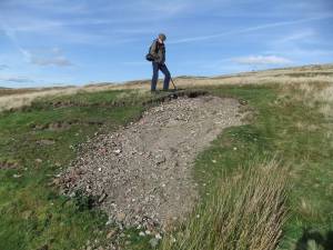 |
| Image 2 ID | 6987 Click image to enlarge |
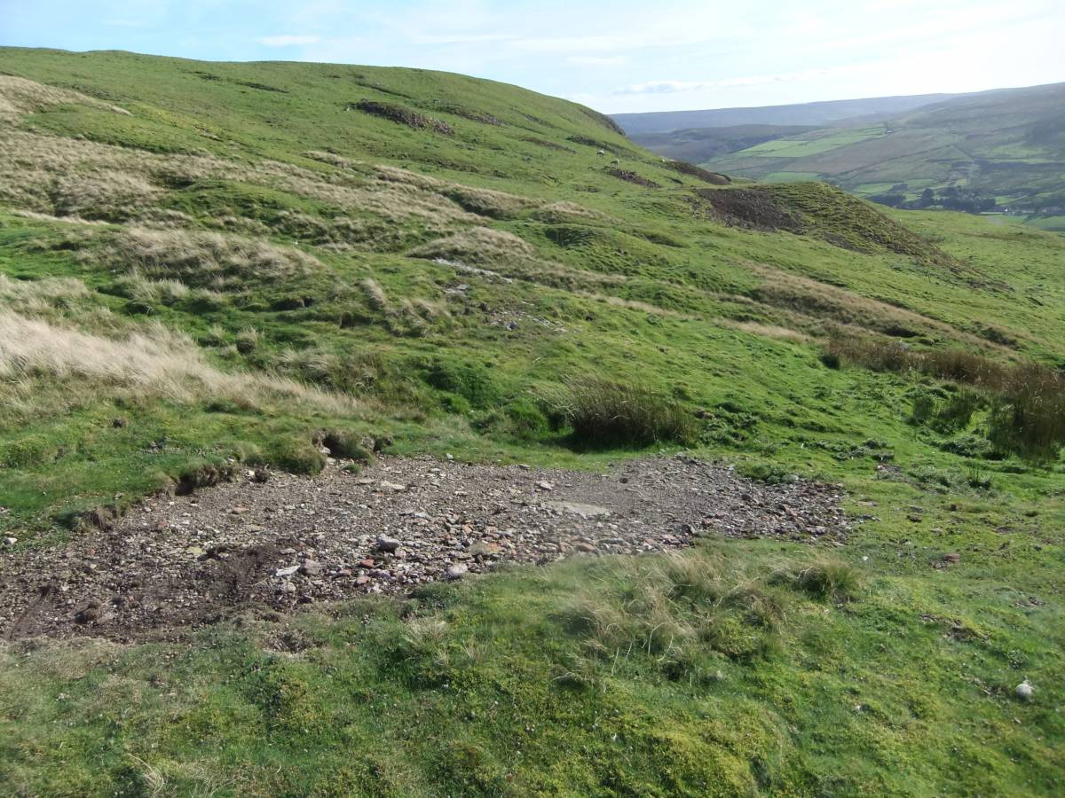
| Image 2 Description | The two bale sites at this location are at the northern edge of the extensive area of workings of different periods on the White Gang Lead Vein | 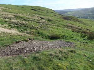 |
| Image 3 ID | 6988 Click image to enlarge |
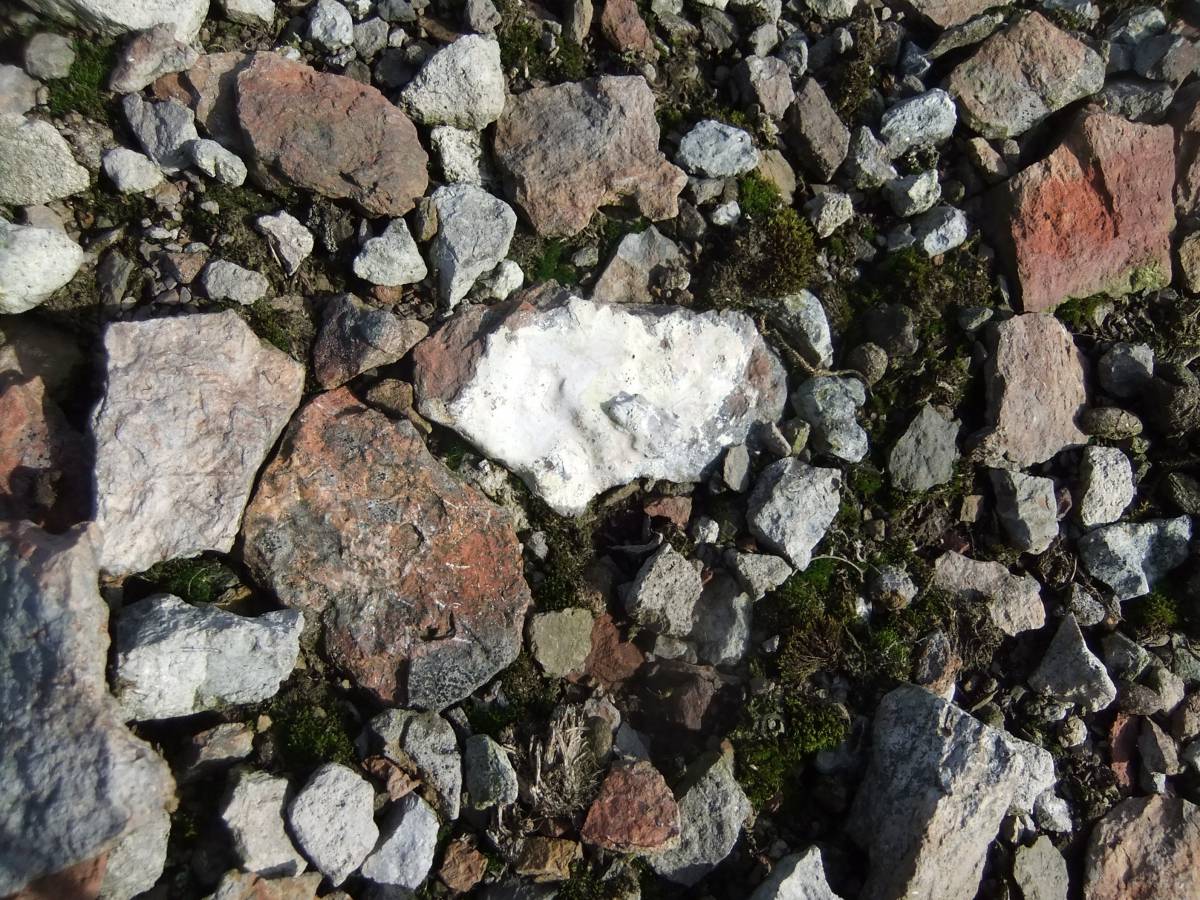
| Image 3 Description | Burnt stone and creamy splashes of lead silicate | 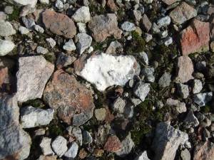 |
| Image 4 ID | 6989 Click image to enlarge |
| Image 4 Description | The bale site is revealed by erosion of the turf and peat which conceals most of this site. | 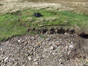 |
| Image 5 ID | 6990 Click image to enlarge |
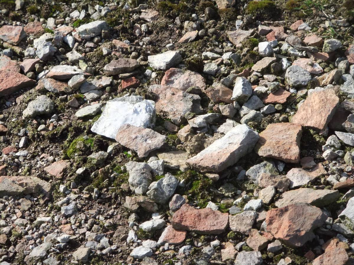
| Image 5 Description | Burnt stone and lead silicate splashes at the bale. | 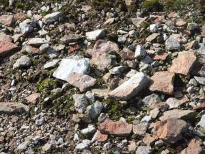 |
| Image 6 ID | 6994 Click image to enlarge |
| Image 6 Description | The more southerly of the two adjacent bales is located at the northern edge of the area of workings on the White Gang Lead Vein. | 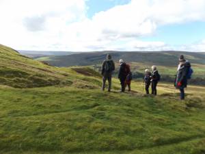 |
| Image 7 ID | 6991 Click image to enlarge |
| Image 7 Description | The more southerly of the two bales is located at the northern edge of the area of workings on the White Gang Lead Vein. |  |
| Image 8 ID | 6992 Click image to enlarge |
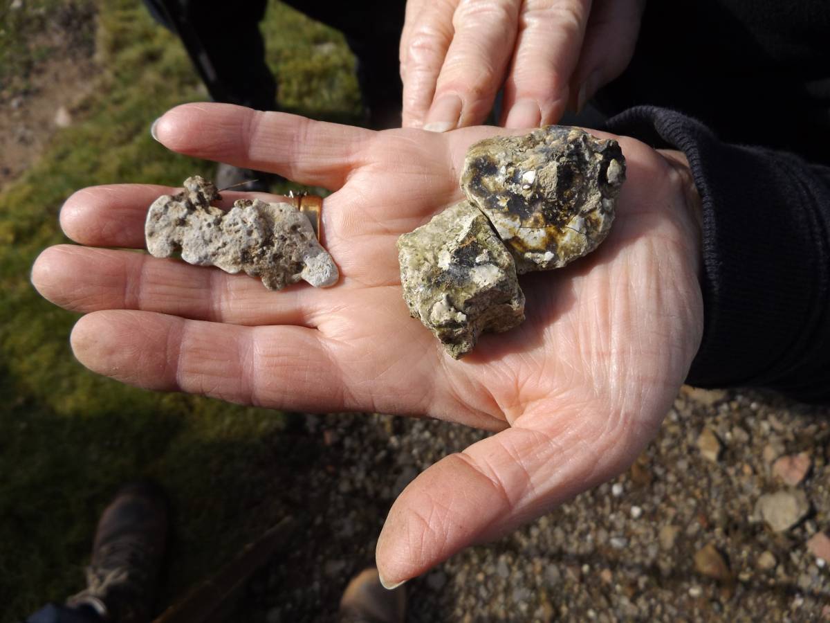
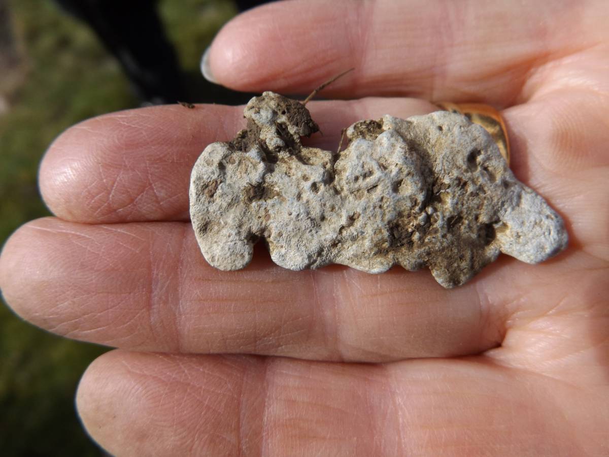
| Image 8 Description | Vitrified slag and a prill of oxidised lead metal. | 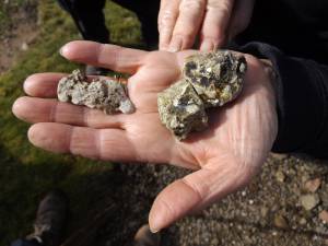 |
| Image 9 ID | 6993 Click image to enlarge |
| Image 9 Description | Detail of the lead prill found at the bale site. |  |